Bohsdorfer Diapir
Site Description
The sharply cut longitudinal valleys known as giesers are among the most striking morphological landforms in the Muskauer Faltenbogen. They did not arise in the course of the upwards compression of the Faltenbogen, but rather represent the result of a completely independent process. As a result of glacial compression, the clay, sand and lignite layers in the bedrock are folded or steeply tilted, causing them to crop out at the surface. At the earth’s surface, the lignite begins to oxidise under the influence of oxygen in the air. The oxidation process is associated with a loss in volume of the lignite, causing the ground above the coal seam to sink. So-called diapirs represent one particular fold structure. These are upright folds in which the layers in the fold core have breached the “roof” (the bend range of the fold).
Data
Německo
2 / 5
0.5 hours.
156 m
What will you see here?

1
The Bohsdorfer Diapir (red circle) is an approximately 150 m upright fold, the upper part of which no longer exists.

2
With a digital terrain model it is possible to depict the course of the gieser over the Bohsdorfer Diapir.

3
Deeply cut, dead straight gieser with birch vegetation characteristic of damp habitats.
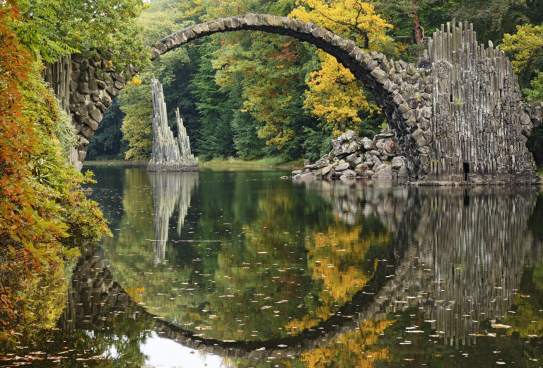
Do you know that...
For Curious Minds
How to Reach Us
- Friedrichshain, Felixsee, Německo
- 51.608964 N, 14.558993 E
Site Photo Gallery
DISCOVER OTHER GEOPARK SITES

Kromlauer Park
The Kromlauer Rhododendronpark: a precious 19th century cultural monument and landscape park


