Elefant’s back und observation tower
Site Description
Despite its mysterious name, the elephant’s back is nothing more than one of many erosion forms located along the “Ehemalige Grube Babina” geotouristic trail. The small dome-shaped hill on the edge of the basin represents the remains of the unusable rock tip, as well as the peninsula, which is visible even from a distance. On account of its shape, this peninsula is also named “Elefantenrücken” (En: Elephant’s back). It is not only a landmark of the trail, but also one of the most popular photo scenes. Furthermore, it is worth noting that this erosion form is situated on the largest former mining lake of the trail, named “Afrika” (En: Africa), after its distinctive shape which is best observed from the observation tower. The base of the tower stands 148 metres above sea level, and it has two observation decks: at heights of 14 and 24 metres. When visibility is good, mountains can be seen in the distance. However, your attention is bound to be drawn to the clouds rising vertically from the horizon. Where do they come from?
Data
Německo
2 / 5
3 hours.
148 m
What will you see here?

1
"Der Elefantenrücken" (En: Elephant's back), part of the former waste tip of the hanging wall rock.

2
Part of the former mining lake "Afrika" (thrust slice C).

3
Observation tower on Afrikasee lake.
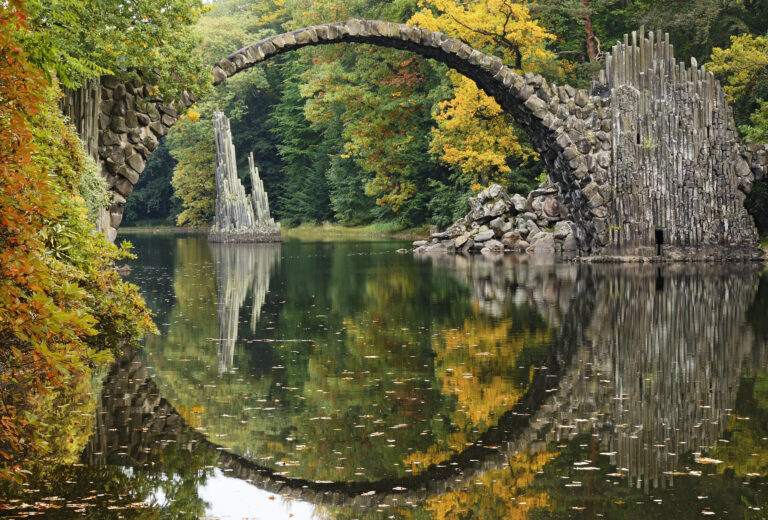
Do you know that...
How to Reach Us
- 68-208 Łęknica, Polsko
- 51.542328, 14.774604
Site Photo Gallery
DISCOVER OTHER GEOPARK SITES

Kromlauer Park
The Kromlauer Rhododendronpark: a precious 19th century cultural monument and landscape park


