Kettle near the village Groß Kölzig

The glacier on the retreat

Site Description

Kettles are landscape features which formed during glacial periods. The term originates from Low German and can be roughly translated to “water hole”. When the continental ice sheed retreated at the end of the last glacial period, so-called dead ice blocks remained and were buried under sediments transported by the glacier (moraines). As the ice melts, the material lying above it sinks downward, leading to the formation of often water-filled depressions, usually with a circular shape. Today, the kettle is silted up and only filled with water during periods of elevated precipitation.

Data

Locality

Německo

Terrain difficulty

1 / 5

Time required

0.2 hours.

Elevation difference

135 m

What will you see here?

Soll

1

Melting of the glacier: dead ice blocks remain on the surface or under the transported sediment.

Soll

2

A lake forms after the melting of the dead ice block. Fine sediments collect on the lake bottom.

Soll

3

Today, the lake is silted up.
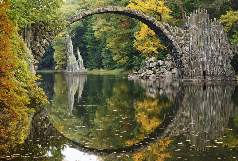
Do you know that...

Did you know that kettles and kettle-like structures are primarily known in the western section of the Muskauer Faltenbogen?

For Curious Minds

Zatím zde není nic ke stažení.

How to Reach Us

Follow the B 115 from the geopark offices to Groß Kölzig, before turning onto Bahnhofstraße. After a few hundred metres, stay right on Alte Heerstraße to the Groß Kölzig kettle, which is located on the crossroads with Conradgrubenweg and Kirschallee.

Site Photo Gallery

DISCOVER OTHER GEOPARK SITES

Each place is unique and hides many layers. Come with us and explore the restored wilderness area.