stop on the geotrail
0
meters high lookout tower
0
stairs to the top of the lookout tower
0
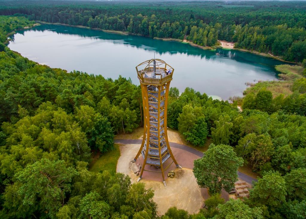
View of Africa
The center of the geotourism trail is a lookout tower right on the shores of Lake Africa. Africa is a lake on the site of the former Conquest C and was named after its shape, which resembles the continent. It is the largest body of water in the Muskauer Faltenbogen Geopark, it has 20 hectares. It has 896m in the longest place and 468m in the widest place. If we wanted to bypass the whole of Africa, we would have to walk 2,625 meters. Depth around 9.7 meters, the deepest place is 24 meters.
Lake Africa with a lookout tower
Trail with educational boards
Area with springs with crusts of mineral sediments
Relaxing tourism