Dragon Mountains (Drachenberge)
Site Description
In the area of the Drachenberge between Krauschwitz (to the east), Weißwasser (to the west), the B 156 (to the north) and the former Weißwasser-Forst railway line (to the south), a gieser landscape unchanged by human activity has survived in an approximately 3 km2 area of pine forest. Here, along a 700m stretch of forest path, five of the largest and deepest giesers in the Muskauer Faltenbogen can be crossed (width approximately 50 m, occasionally up to 70 m, depth 3-15 m).
Giesers are elongated valleys with no outlet. They are formed by the sinking of raised coal seams. As a result of slow oxidation in the area of the air-filled pore space (under the surface, above the water table), the coal undergoes humification and reduces in volume.
Data
Německo
2 / 5
0.5 hours.
23 m
What will you see here?

1
Digital terrain model of the territory of the Drachenberge area (without vegatation). Size: 1.5 x 2 km, topography inflation x2.

2
Cross-section of a gieser, drawn according to an outcrop in the Mulde VII former opencast mine lake near Halbendorf

3
At a depth of 15 m, the double gieser at the southern end of the excursion path is among the deepest in the Faltenbogen.
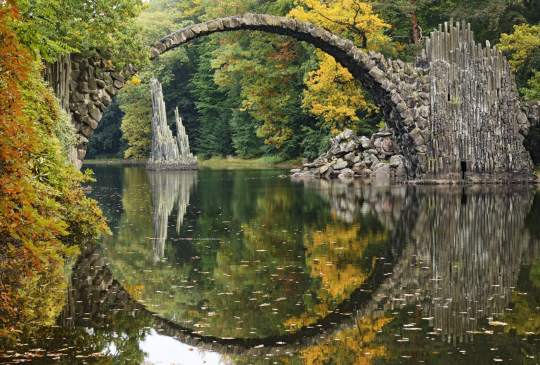
Do you know that...
How to Reach Us
- Gablenz, Německo
- 51.5258733N, 14.6817900E
Site Photo Gallery
DISCOVER OTHER GEOPARK SITES

Kromlauer Park
The Kromlauer Rhododendronpark: a precious 19th century cultural monument and landscape park


