Räderschnitza valley
Site Description
The Räderschnitza is an approximately 8 km long stream in the south of the Muskauer Faltenbogen, which flows from the Triebeler Boden between Muskau and Köbeln into the Lausitzer Neiße. Its headwaters are situated south of the village of Gablenz, near the former mining lake “Karoline” at the end of Wiesengrund road. Starting here as a small grassland streamlet, it develops with increasing gradient into a sharply meandering stream, which carves up to 10 metres deep into the terrain. Its bed is composed predominantly of sands, which are accompanied in flatter sections by gravel and smaller cobbles. Both banks of the stream are lined with common alders and, in parts, small carrs, which exist alongside the dominant pine forest. The entire length of the Räderschnitza valley is accessible by a well-maintained hiking trail.
Data
Německo
2 / 5
3 hours.
150 m
What will you see here?

1
The riparian vegetation makes the course of the Räderschnitza easy to follow on aerial photographs.

2
The gently meandering course of the Räderschnitza north of Gablenz

3
Singposting of the hiking trails
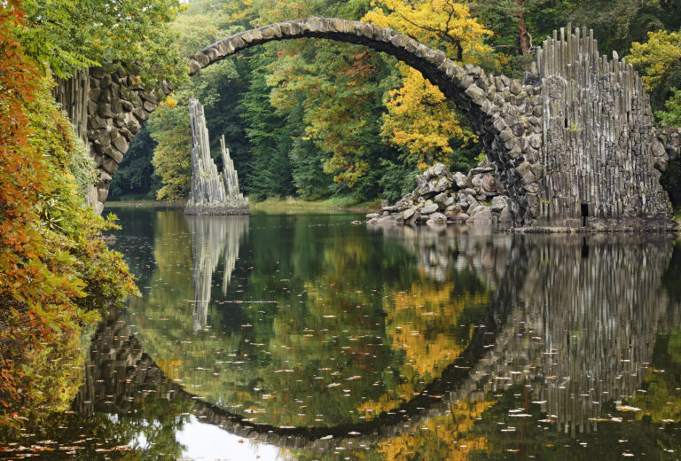
Do you know that...
How to Reach Us
- Bad Muskau, Německo
- 51.5490706N, 14.6807925E
Site Photo Gallery
DISCOVER OTHER GEOPARK SITES

Kromlauer Park
The Kromlauer Rhododendronpark: a precious 19th century cultural monument and landscape park


