Former “Irena” clay pit
Site Description
Starting in the year 1973, clays were mined in the pit to serve brick production. The deposit was locasted in a large, steep, glaciotectonic thrust slice, aligned northeast-southwest. After the conclusion of clay mining, the residual pit was furnished with a clay seal and used as a landfill site for municipal waste. Today the landfill site has been covered and replanted, and is open to the public. An approximately 5 m high, almost vertical former pit wall runs along the northwest face. On its southwestern end, it bends almost perpendicularly towards northwest, revealing a 16 m long, glaciotectonically imbricated stratigraphic profile composed of steep Miocene gravels, sands, silts and clays. In larger sections, the white, sandy clays are formed as lightly compressed claystones. Heavily compressed rocks, known as tertiary quartzites, can also be observed in parts of the profile. They were formed by the silification of originally loose, fine-sandy clays through the action of groundwater.
Data
Německo
1 / 5
0.5 hours.
127 m
What will you see here?

1
Steep glacial thrust slice composed of Pleistocene sands/gravels and Miocene sand/gravel rocks.

2
Right: steep clayey sands/gravels. Centre: brown Pleistocene sands/gravels, over- and underlaid by Miocene rocks.

3
Detailed view: steep Miocene clayey sands/gravels.
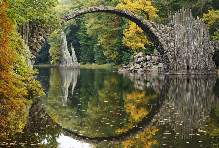
Do you know that...
How to Reach Us
- Łęknica, Polsko
- 51.5280850N, 14.7463219E
Site Photo Gallery
DISCOVER OTHER GEOPARK SITES

Kromlauer Park
The Kromlauer Rhododendronpark: a precious 19th century cultural monument and landscape park


